
##AdventureTravel
##Dhanushkodi
##HanleStargazing
##IndiaHiddenGems
##IndiaTravel2026
##Jaisalmer
##JulyAugustTravel
##LadakhTravel
##LowRainIndia
##MagicSafari
##MonsoonEscape
##MonsoonTravel
##RainShadowDestinations
##SpitiValley
##TharDesert
##ZanskarValley
#Where to Go in India When It's Pouring Everywhere Else: The Best Low-Rain Destinations for July–August 2026
Best Low-Rain Destinations in India for July–August 2026 | Ladakh, Spiti, Jaisalmer & More
By: Magic Safari | June 2026
Most of India Is Drenched. These Places Are Not.
Every June, the southwest monsoon rolls in from the Arabian Sea, sweeps across the Western Ghats, and proceeds to drench most of India for the next three months. By July, Mumbai is flooded, Kerala is saturated, the Himalayan foothills are hammered by relentless rain, and most popular hill stations are wrapped in cloud and wet roads.
And yet — some parts of India barely notice.
These are the rain-shadow zones and arid deserts: places where geography itself acts as an umbrella. The Great Himalayan ranges block the monsoon clouds before they can reach Ladakh and Spiti. The Thar Desert in Rajasthan is simply too dry for the monsoon to make much of an impression. And the tip of Tamil Nadu — the narrow finger of land where the Indian Ocean meets the Bay of Bengal — sits in the path of the northeast monsoon, which doesn’t arrive until October, leaving July and August extraordinarily dry.
For travellers willing to look beyond the obvious, July and August are actually among the best months to visit these destinations — quieter than the main summer rush in many cases, visually dramatic in others, and free from the grey, wet weather that descends on the rest of the country.
Here is the complete, fact-checked guide to India’s best low-rain escapes for 2026.
At a Glance: Rainfall Comparison Chart
| Destination | July Rainfall | August Rainfall | Why It Stays Dry |
|---|---|---|---|
| Leh, Ladakh | ~15 mm | ~15 mm* | High-altitude cold desert, Himalayan rain shadow |
| Kaza, Spiti Valley | ~15 mm | ~15 mm | Tibetan plateau rain shadow |
| Jaisalmer, Rajasthan | <20 mm | <25 mm | Thar Desert arid climate |
| Dhanushkodi, Tamil Nadu | ~1 mm | ~25 mm | Coromandel coast rain shadow (NE monsoon only) |
| Zanskar Valley | Very low | Very low | Remote high-altitude, isolated from moisture |
*Note: In August 2025, Leh recorded 80.2 mm — its highest August total in 52 years. Rain-shadow status does not guarantee dryness in every year. Always check IMD forecasts.
Ladakh (Leh–Nubra–Pangong): The Cold Desert at the Top of the World
India’s Most Dramatic Monsoon Escape
Ask seasoned Indian travellers where they go when the rest of the country is underwater, and most will say the same thing: Ladakh.
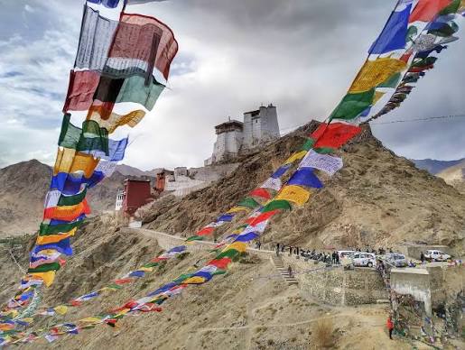
Sitting at an average altitude of over 3,000 metres and shielded from the southwest monsoon by the Great Himalayan and Zanskar ranges, Ladakh receives an average of just 15 mm of rainfall in both July and August combined — less than what Mumbai gets on a single heavy afternoon. The landscape is a cold desert: vast, bare, extraordinary. Brown mountains striped with mineral colours, turquoise rivers cutting through boulder fields, monasteries perched on impossible ridgelines, and a sky that turns a shade of blue you simply do not see at lower altitudes.
Leh, the capital, is the natural base. At 3,524 metres, it has good hotels, a fast-growing café and restaurant scene, and easy access to the rest of the territory. From Leh, the two classic circuits unfold.
The Nubra Valley Circuit
North of Leh, the road crosses the Khardung La pass — at approximately 5,359 metres, among the world’s highest motorable roads — and descends into the wide, flat Nubra Valley. The valley has a split personality: on one side, the Shyok River curves past green poplar groves and apricot orchards; on the other, sand dunes have built up over millennia around the village of Hunder, where Bactrian double-humped camels still roam, left behind by Silk Road caravans centuries ago.
The Diskit Monastery here, founded in the 14th century and presiding over the valley from a ridgetop, is one of Ladakh’s most atmospheric places of worship. A giant Maitreya (future Buddha) statue faces down the valley, arms raised, as if blessing the landscape below. July and August are when the valley is most accessible and most green — a short window of living colour in an otherwise arid landscape.
Pangong Lake: Where the Sky Meets the Water
Southeast of Leh, a long, dramatic drive brings you to Pangong Tso, a salt lake at 4,350 metres that stretches 134 kilometres from India deep into Chinese-controlled Tibet. Only about 45 kilometres of it falls within Indian territory, but that is more than enough. The lake changes colour constantly — pale blue at dawn, electric cyan by midday, deep indigo at dusk — and the barrenness of the surrounding mountains, the absence of any vegetation, and the sheer silence of the place make it feel like another planet.
In July and August, Pangong is at its most vivid. The sky is clear, the lake is accessible, and the temperature — cold at night, crisp and cool during the day — is ideal for exploring. Campsites and eco-lodges along the south bank offer some of the most distinctive accommodation experiences available anywhere in India.
Hanle: India’s First Dark Sky Reserve — and a New Kind of Travel
Two hundred and seventy-five kilometres from Leh, in the remote Changthang plateau of eastern Ladakh, the tiny village of Hanle is quietly becoming one of the most remarkable travel destinations in Asia.
In December 2022, the Government of Ladakh officially designated Hanle as India’s first International Dark Sky Reserve, centred around the Indian Astronomical Observatory (IAO). The reserve is managed by the Indian Institute of Astrophysics under the Department of Science and Technology.
The skies here are classified as Bortle-1 — the darkest category possible — and Hanle enjoys approximately 270 cloud-free nights per year. The village now has 24 trained Astronomy Ambassadors, selected from local Hanle villages and trained by the Indian Institute of Astrophysics, who guide visitors through the night sky with telescopes.
<cite index=”25-1″>Since the reserve was created, visitor numbers have climbed sharply, with estimates of around 10,000 tourists in 2024 — up from just a few thousand annually before the pandemic.</cite> In 2026, Ladakh is hosting its inaugural Astro Week, positioning the territory as South Asia’s premier destination for astronomy-based tourism, with Hanle at the centre.
For travellers, Hanle means accommodation in local Ladakhi homestays — warm, personal, utterly authentic — with the Milky Way visible in full from the rooftop, without a telescope, on any clear night.
The Honest Risk Advisory for Ladakh
The rain-shadow status is real, but it is no longer absolute. In August 2025, Leh recorded 80.2 mm of rainfall — its highest August total in 52 years, more than five times the IMD normal of 15.4 mm. The same month brought flash floods to Lamayuru on the Srinagar–Leh highway and a cloudburst at Charkat Nallah in Kargil. Climate patterns are shifting. Ladakh remains the driest option in India, but travellers should check IMD forecasts and BRO road updates before and during travel.
Altitude sickness is the other major consideration. Leh sits at 3,524 metres. Pangong is at 4,350 metres. Hanle is at 4,300–4,500 metres. Acclimatisation is not optional — it is essential. Plan at least two full rest days in Leh before driving to higher areas. Carry Diamox (consult your doctor), stay hydrated, eat light the first two days, and avoid alcohol at altitude.
Temperature range: Cool days of 15–25°C; cold nights that drop to 5–10°C. Pack layers regardless of season.
Spiti Valley: The Tibetan World Inside India
The Valley That Barely Knows Monsoon Exists
Separated from Ladakh by the Kunzum Pass and from the rest of Himachal Pradesh by one of India’s most difficult approach roads, Spiti Valley is a high-altitude cold desert that sits firmly in the rain shadow of the Great Himalayas. <cite index=”45-1″>Spiti sits in a rain-shadow zone, so real monsoon downpours hardly touch it. Actual rain in Spiti is under 200 mm all year. Neighbouring spots like Kinnaur and Manali soak up much more, so their roads may slow you down.</cite>
The valley’s main town, Kaza, sits at 3,800 metres. The villages scattered across the landscape — Komic (one of the world’s highest inhabited villages, at 4,513 metres), Hikkim (home to the world’s highest post office), Langza (famous for fossils and a giant Buddha statue) — belong to a world that looks and feels more like the Tibetan plateau than the India most people know.
The monastery circuit is extraordinary. Ki Monastery, perched on a rocky hill above the Spiti River, has functioned continuously since the 11th century and still houses over 300 monks. Tabo Monastery, founded in 996 AD, is sometimes called the “Ajanta of the Himalayas” for its ancient murals. Dhankar Monastery balances improbably on a narrow cliff above the confluence of the Pin and Spiti rivers — one of the most dramatically sited buildings in India.
And then there is Chandratal Lake — the Moon Lake — a perfect kidney-shaped body of turquoise water at 4,300 metres, surrounded by peaks, accessible only on foot or in high-clearance vehicles, and so beautiful it makes experienced Himalayan travellers stop and simply stand in silence.
Spiti Valley weather remains cool and pleasant during August and the broader monsoon period. Daytime temperatures range from 15 to 25 degrees Celsius, while nights can drop to 5 to 10 degrees Celsius.
Getting In: The Route Question Every Spiti Traveller Faces
Spiti has two access routes, and choosing between them in July–August requires current intelligence.
The Shimla–Kinnaur–Kaza route (NH-5) is the more reliable of the two in monsoon season. It is longer — around 415 kilometres from Shimla — but the gradient is gentler and the road is technically open year-round. The caveat: NH-5 took heavy damage during the 2025 monsoon — especially around Nigulsari and the Pooh–Kaurik stretch in Kinnaur. Repair work continues through 2026, so even the reliable backbone route has single-lane stretches and holding patterns at repair zones.
The Manali–Kaza route via Rohtang Pass (or the Atal Tunnel) and Kunzum Pass is the more adventurous option — roughly 200 kilometres and visually stunning — but it is also more vulnerable. In August, due to loose soil caused by rains, the risk of encountering shooting stones and landslides increases.The approach roads to Spiti from the Manali side pass through monsoon-affected areas. This means you may face heavy rain, landslides, and swollen nallahs on your way in, even though Spiti itself remains relatively dry.
The practical advice from experienced Spiti travellers: enter via Shimla, exit via Manali (or reverse). This way you experience both routes, have the safer approach on arrival, and get the more dramatic exit if conditions allow. Always carry extra cash (ATMs are scarce after Reckong Peo), pack fuel for long stretches, and keep a buffer day in your itinerary.
Altitude note: Spiti averages 12,500 feet above sea level. The same acclimatisation protocol as Ladakh applies.
Jaisalmer, Rajasthan: Where the Desert Laughs at Monsoon
The Golden City in High Summer
In July and August, Rajasthan’s Thar Desert does what it has always done: stays dry. While the rest of India watches water levels rise, Jaisalmer — the golden city at India’s western edge — receives fewer than 20 mm of rainfall in July and similar figures in August. The sky stays large and blue. The sandstone of the Jaisalmer Fort — one of the few living forts in the world, with approximately 3,000 people still residing inside — glows amber in the afternoon sun. The dunes at Sam and Khuri, 40–45 kilometres from the city, roll on without interruption.
This is a different kind of escape from the mountain destinations. There is no altitude to contend with, no permits required, no road uncertainty. What there is instead: space, silence, and a quality of light that photographers travel across the world for.
What makes Jaisalmer exceptional in July–August:
The tourist crowds — which can be substantial in winter, Jaisalmer’s peak season — thin considerably in summer. Accommodation rates drop. Desert camps that charge premium prices in November and December become far more accessible. And the heat, while real, comes with the advantage of dramatically clear skies, golden-hour photography that lasts longer than elsewhere, and the particular peace of a desert town that has been weathering summer since ancient times.
Key experiences: The Jaisalmer Fort (Sonar Quila) with its Jain temples and narrow lanes; the ornate havelis of Patwon Ki Haveli and Salim Singh Ki Haveli; camel safaris across the Sam Sand Dunes (best done at dawn or dusk, avoiding midday); jeep safaris into the deeper desert; fossil parks near Akal; and the remarkable sight of the migratory Great Indian Bustard — critically endangered, with Jaisalmer as one of its last strongholds — at the Desert National Park.
The heat reality: Jaisalmer in July sees temperatures of 35–40°C during the day, occasionally higher. This is not a destination for outdoor activity between 11 AM and 4 PM. Structure your days around early mornings, evenings, and air-conditioned midday breaks. Desert safaris and fort walks are ideal at dawn or in the two hours before sunset.
Dhanushkodi and Rameswaram, Tamil Nadu: The Driest Shore in India
Where Two Oceans Meet and the Rain Forgets to Arrive
At the very southern tip of Pamban Island, 20 kilometres from Rameswaram, the narrow strip of land called Dhanushkodi ends abruptly at a point where the Bay of Bengal meets the Indian Ocean. There is no road beyond it. Sri Lanka is visible on clear days, less than 30 kilometres away. The ruins of a town destroyed by a cyclone in December 1964 — a railway station, a church, a post office, slowly swallowed by sand — give the place an atmosphere unlike anywhere else in India.
It is also, in July, among the driest places in the entire country.
July has total rainfall of 0.1 cm, making it extremely dry with very few light showers and most days are rain free. There are just 3 days with some rainfall, so visitors can enjoy the beach on the majority of rain-free clear days. The reason is climatological: the Western Ghats block the Arabian Sea monsoon, and this strip of Tamil Nadu gets its rain in October–December from the northeast monsoon instead.
August sees total rainfall of 2.5 cm — still predominantly dry with occasional light showers on very few days, with just 6.3 days with some rainfall.
The honest caveat: Some local guides and travel advisories do warn that heavy rainfall and unpredictable storms can occasionally occur during July to September, and fishing stops during this time as local fishermen leave for nearby towns. The statistical average is very dry, but the Indian Ocean coastal location means occasional storm activity cannot be entirely ruled out. Check forecasts before visiting, and be cautious near the water on any rough-weather day.
The Rameswaram combination: Most visitors pair Dhanushkodi with Rameswaram town, home to the magnificent Ramanathaswamy Temple — one of the twelve Jyotirlinga shrines of Lord Shiva, and one of the most significant pilgrimage sites in India. The Pamban Bridge (and the adjacent new cable-stayed Pamban Rail Bridge, India’s first vertical-lift railway sea bridge, inaugurated in 2024) is a visual highlight in itself. The crossing from the mainland to Pamban Island, over open ocean, is one of the most distinctive approaches to any destination in India.
Temperature in July–August: Average maximum temperatures of 36°C (98°F) — scorching hot and ideal for beach mornings and evenings, but best avoided at midday. Sea temperature is a warm 28°C — comfortable for swimming throughout the day on calm-weather days.
Zanskar Valley: India’s Most Isolated Dry Escape
Beyond the Map
If Spiti is remote, Zanskar is in a different category entirely. Enclosed on all sides by high mountain walls and accessible for only a portion of the year, this sub-district of Ladakh sits in a deep valley system carved by the Zanskar River. It receives very little monsoon moisture — protected by the same Himalayan barrier that keeps Ladakh dry — and is home to some of the most extraordinary trekking terrain and monastery culture in the Himalayas.
Padum, the main town, sits at 3,500 metres and serves as the base for exploring the valley. The monasteries here — Karsha, the largest in Zanskar; Phugtal, a cave monastery built into a cliff face that looks like something from a fantasy novel; Zangla — are largely free of the tourist traffic that can crowd the more accessible sites in central Ladakh.
The access road from Kargil via Panikhar and the Pensi La pass (4,401 metres) is typically open from late June through October. A newer route via the Shinku La pass from the Lahaul side of Himachal Pradesh has also become operational in recent years, offering an alternative approach.
Zanskar is not for first-time Himalayan travellers or those with tight itineraries. Roads are rough, services are basic, mobile connectivity is minimal, and conditions can change rapidly. But for experienced trekkers and travellers seeking something genuinely off the beaten track, it is among the most rewarding places in India.
Practical Planning: What You Need to Know Before You Go
Permits and Documentation
Ladakh: Inner Line Permits (ILP) are required for restricted areas including Nubra Valley, Pangong Lake, and Hanle. These can be obtained online through the official Ladakh tourism portal or in person at the DC office in Leh. Carry multiple copies. Foreign nationals require separate permits and cannot access certain areas close to the international border (including Hanle, which was recently opened to tourists with the required permit). Verify current regulations before travel.
Spiti: No special permit required for Indian nationals. Foreign nationals need an ILP for certain restricted zones in Kinnaur and Spiti.
Jaisalmer & Dhanushkodi: No special permits required. Standard ID documentation sufficient.
Booking Accommodation
July and August see high tourist inflow in Ladakh and Spiti. These regions are still the driest options in the country, and their popularity during July–August means accommodation books up quickly. Book at least 6–8 weeks in advance for Leh hotels, Nubra camps, and Pangong lakeside stays. In Spiti, accommodation is sparser — plan and book each night in advance, especially in peak July.
In Hanle, the only accommodation available is local Ladakhi homestays. Staying in these homestays is genuinely special — warm home-cooked food, ancient culture, and at night, the entire Milky Way visible from the terrace without a telescope.
In Jaisalmer, summer rates are significantly lower than winter peak — use this to your advantage and choose the desert camp you actually want.
Staying Safe: The Non-Negotiable Checklist
Altitude sickness prevention Anyone travelling to Ladakh, Spiti, or Zanskar must take altitude seriously. Symptoms — headache, nausea, dizziness, fatigue — can appear at altitudes above 3,000 metres. Rest on arrival day, hydrate constantly, avoid alcohol for the first 48 hours, and ascend gradually. Carry Diamox only after consulting a physician, as it is not suitable for everyone.
Road condition monitoring BRO (Border Roads Organisation) maintains road updates for Ladakh and Himachal Pradesh routes. Check the BRO website or Manali BRO office (tel: +91 1902 252476) for current status. IMD (India Meteorological Department) issues regional forecasts — check 24–48 hours before each journey leg.
The climate change caveat Even rain-shadow regions occasionally see unexpected showers — sometimes severe ones. In August 2025, Leh saw rainfall five times its historic norm. These regions are still the driest options in the country, but they are no longer the guaranteed-dry options they were a decade ago. Always carry a quality waterproof layer, plan buffer days in your itinerary, and treat forecasts as important information, not background noise.
Heat management for Jaisalmer Carry more water than you think you need. Start outdoor activities before 9 AM. Rest indoors from 11 AM to 4 PM. Wear light, loose, full-coverage cotton clothing — it breathes better than synthetics and protects against both sun and desert dust.
Which Destination Is Right for You?
| Your Travel Style | Best Destination |
|---|---|
| Dramatic landscapes, stargazing, monastery culture | Ladakh (Leh–Nubra–Pangong–Hanle) |
| Remote adventure, Tibetan culture, serious trekking | Spiti Valley |
| Heritage, desert landscape, gentler pace | Jaisalmer |
| Coastal spiritual journey, easy access | Dhanushkodi + Rameswaram |
| Total isolation, expert trekkers only | Zanskar Valley |
| Young children or elderly travellers | Jaisalmer or Rameswaram (low altitude, easier access) |
Final Word: The Monsoon Is Not a Reason to Stay Home
The instinct to pause travel in July and August is understandable — and for most of India, sensible. But that instinct ignores the small, extraordinary fraction of India’s geography where the monsoon simply does not show up.
Ladakh’s high-altitude cold desert, Spiti’s Tibetan plateau, the Thar Desert’s arid expanse, and the Coromandel coast’s climatological quirk are not consolation prizes for not going somewhere wetter. They are remarkable destinations in their own right — and July–August, when the rest of India’s tourist destinations are crowded, expensive, and rained on, is often the best time to experience them.
Plan with honesty about the risks. Book early, carry layers, monitor road conditions, and acclimatise responsibly. Then step into a July sky over Pangong Lake, or stand on the tip of India at Dhanushkodi at sunrise, or watch the Milky Way from a Hanle rooftop — and you will understand exactly why seasoned travellers look forward to monsoon season.
All rainfall figures and travel advisories verified against IMD data, BRO road updates, and on-ground travel intelligence current to June 2026. Road conditions and permit requirements are subject to change; always verify before travel.
Planning a Ladakh, Spiti, Jaisalmer, or Dhanushkodi trip for July–August 2026? Explore curated packages and expert-guided itineraries with Magic Safari.